|
Garden Case Study (cont'd) |
|
Garden Map Display Submodel After the garden model had been deployed as a database we were able to track many useful facts in a
fairly straightforward way. But our gardener wanted more. They liked being able to manage plantings but also wanted to be able
to manage on a larger scale. For example, they wanted to keep track of watering, fertilizing, and pest control for whole garden areas that might include entire garden beds.
They also wanted to actually see and interact with representations of the garden they were managing.
This introduced some new concepts and changed some of our previous assumptions, especially about Beds and Locations.
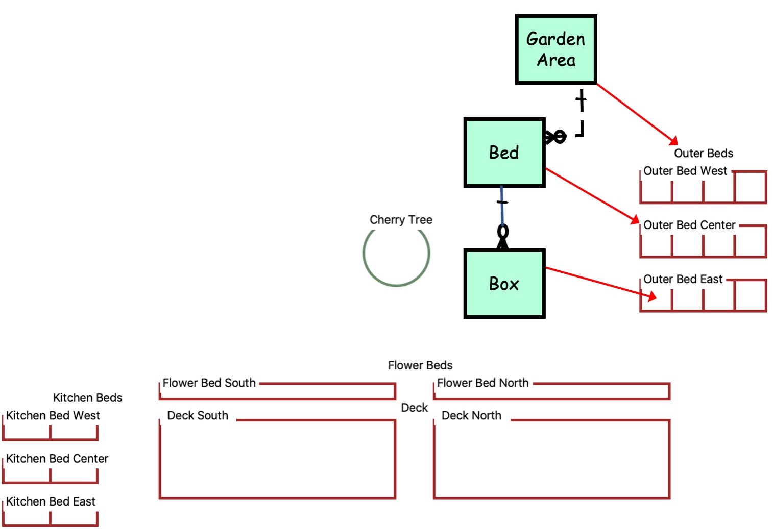
For example, a bed had been modeled as a type of container residing in a location. The gardener, however views a bed
as far more than just a container for plantings. To the gardener, a bed is one of several specific places on the property each with its own characteristics such as orientation and dimension. Some kinds
of beds include two or more boxes. Others, like the flower beds and decks are not subdivided. Most are in areas that contain groups of two or more beds. The idea of representing the garden features in a display introduces a whole new domain of information. We have to present the garden as a schematic map that the gardener could interact with. This meant we had to include some new types of information concerning relative geographical locations and rules for converting physical dimensions to pixels in a display.
© 2023 Datamorphosis Inc. - P.O. Box 11498 Bainbridge Island WA 98110 - (206) 842-1100 www.datamorph.com |
